Unique Attractions of Beringia National Park Now Available on Interactive Map
 ABOUT CLIENT
The customer of the project is the Beringia National Park, a Russian nature reserve lying on the Chukotka Peninsula. The nature reserve is known for its abundant flora and fauna. A lot of plants and animals that live in this area are listed in the Red Data Books of Russia, Chukotka and IUCN. 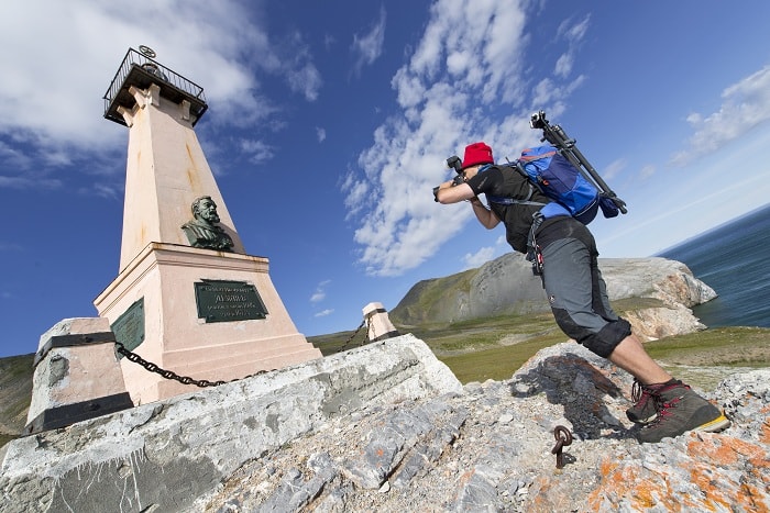
During your walk through the Beringia Park you can observe bird colonies, rookeries of walruses and seals, and polar bears in their natural habitat. With hard-to-reach seashore and tundra landscapes, the Beringia National Park is recognized as a World Heritage site. The park is also famous for stretching to the easternmost point of Russia-the Cape Dezhnev.
 PROJECT MISSION
A rare traveler would venture to take a journey to Chukotka due to its harsh climate and see with his own eyes breathtaking beauty of natural wonders across vast expanses of the Beringia National Park. The project mission was to give a chance to museum visitors to discover wildlife areas of the park and learn more about natural wonders of Russia. Our task was to create a product that would present natural objects using modern tools and in a visually compelling format.
 SOLUTION
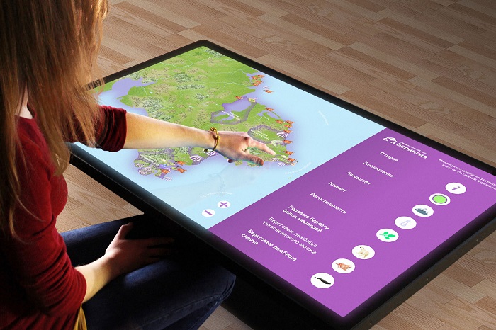
We decided to display all natural features of the Beringia National Park using an interactive touch screen map. This would allow us to combine maximum valuable information in a single product and at the same time display it in a visually appealing format.
The interactive map of the Beringia National Park contains key information about flora and fauna of this region. For example, the walrus icon indicates locations that every year provide habitat for rookeries of Pacific walruses, and the bones icon indicates locations in which you can see racks of whale jaw and rib bones. The map also shows 4 functional areas of the park, including the wildlife area, protected area, recreation area and administrative area.
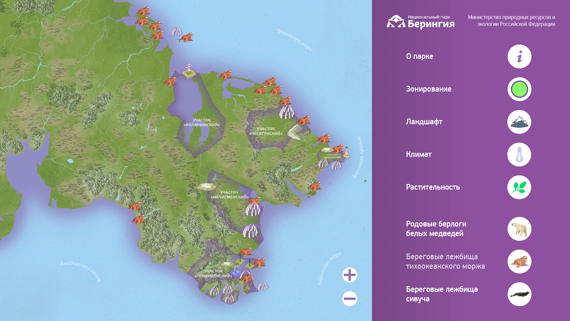
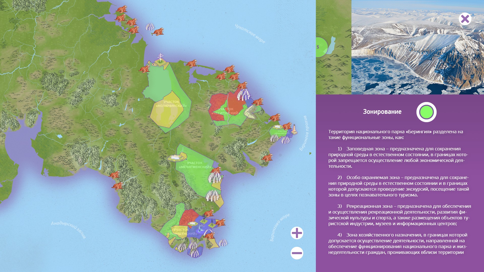
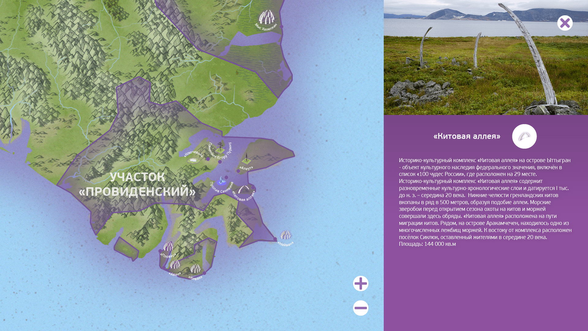
The user can zoom in for a more detail study of all objects and drill down into any desired object. By touching an object on the right part of the screen the user can open an information block which contains details on the selected object in textual and graphical format. Photos of rare species of flora and fauna were provided by the Research Center at the nature reverse.
 RESULT
Currently, the interactive map is a part of the Beringia exposition at the Museum Center Chukotka Heritage. For convenience of exploring the map by museum visitors we used a touch screen table. The table is sized so that each visitor could easily interact with the map.With a vandal proof enclosure, the touch screen table with the nature reserve interactive map will serve the museum long years and will delight travelers who visit this unique region!
Like the project, and want to create something like that?